

Map-n-Compass app for iPhone and iPad
Developer: Digital Confections LLC
First release : 12 Sep 2013
App size: 127.11 Mb
Map-n-Compass is a specialized app designed for those interested in Orienteering and Amateur Radio Direction Finding navigation sports. The app is designed specifically for individuals and groups interested in learning and practicing these outdoor navigation sports. If these navigation sports are not your passion, then this app may not be for you.
PLEASE NOTE: Continued use of GPS running in the background can dramatically decrease battery life.
This app is about getting outside, designing courses, and navigation:
Map-n-Compass is designed to help beginners develop the skills needed for Orienteering and Amateur Radio Direction Finding navigation sports.
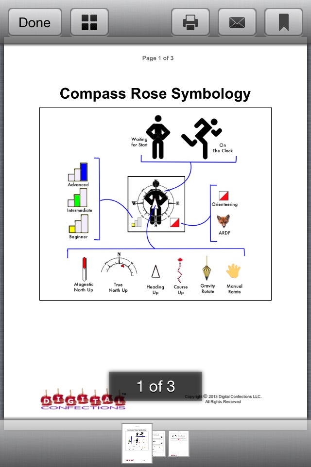
The beginner skill level lets newcomers learn without frustration. Intermediate and advanced skill levels provided progressively more challenge.
For event organizers the app provides support for designing and distributing courses and holding informal practice sessions with minimal cost and effort.
Please contact Digital Confections to provide suggestions for enhancing the app!
FEATURES
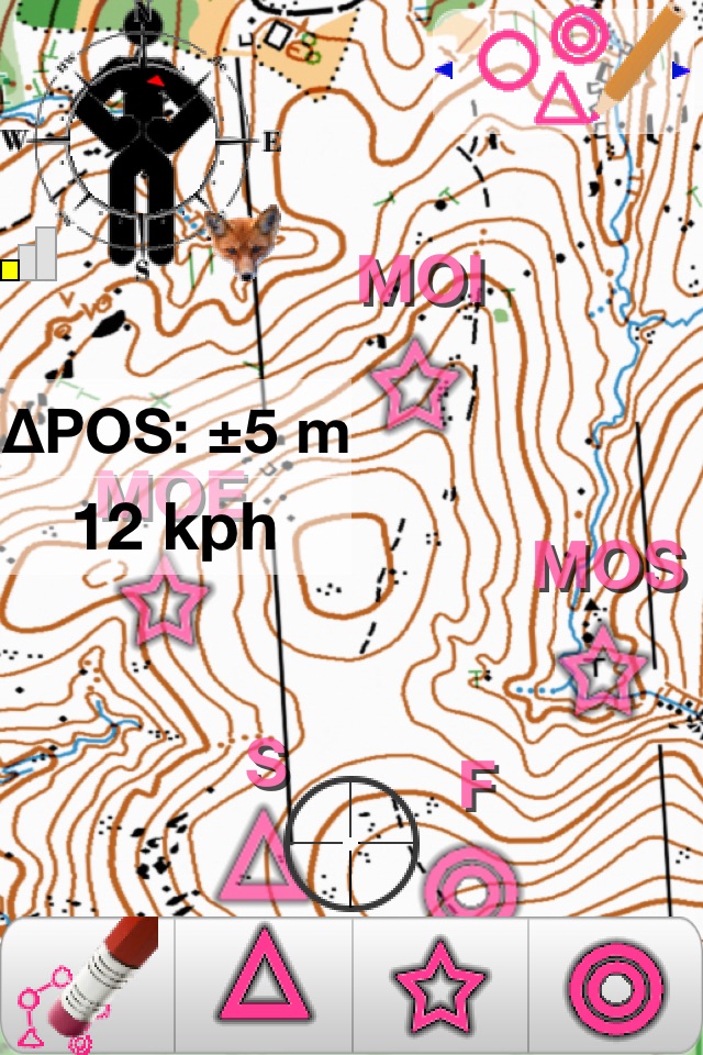
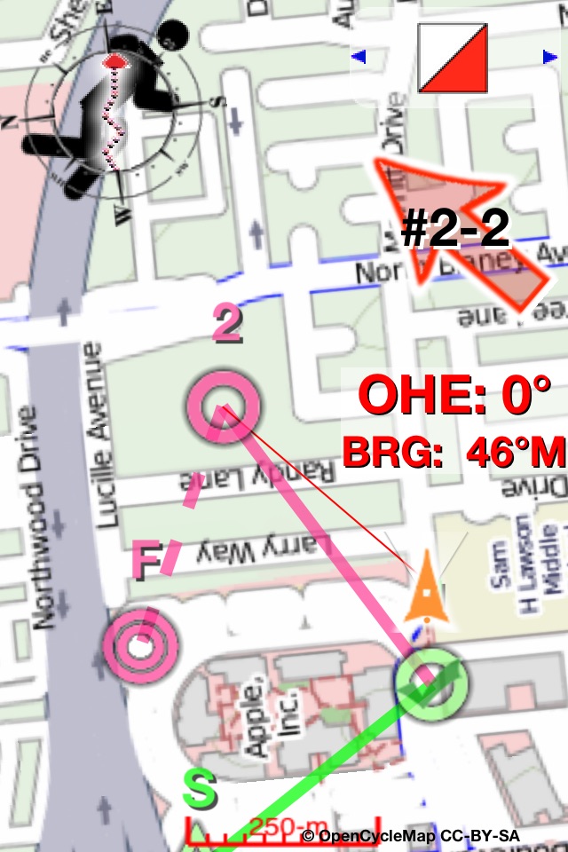
Groups with multiple iOS devices running the app can hold informal practice sessions with minimal cost and effort. The map, the compass, courses, controls, and results recording are all supported within the app. Assorted "streamed" street maps are available within the app, or custom maps can be downloaded and displayed within the app, and a small sample map is provided for illustration.
o Help is available within the app - just swipe up on any available overlay or button to access specific help.
o Universal - the app is fully functional on iPhones and iPads with GPS.
o The app works even on "deactivated" devices lacking cellular network coverage. (Streamed maps and email will not be available without network coverage.)
o GPS data is digitally filtered to enhance position accuracy.
o Results files contain track, overall results and splits.
o Course and Results file sharing by email or iTunes file sharing.
o KML-format course and results files are compatible with free mapping software available from popular vendors.
o Custom map tile databases that you create and install are supported.
o Digital compass data provides directional information.
o Tiered support for beginner, intermediate and advanced skill levels.
o Multiple options for automatically rotating the map.
o Built-in timers: Time of day clock, Elapsed time, Overtime countdown with alarm.
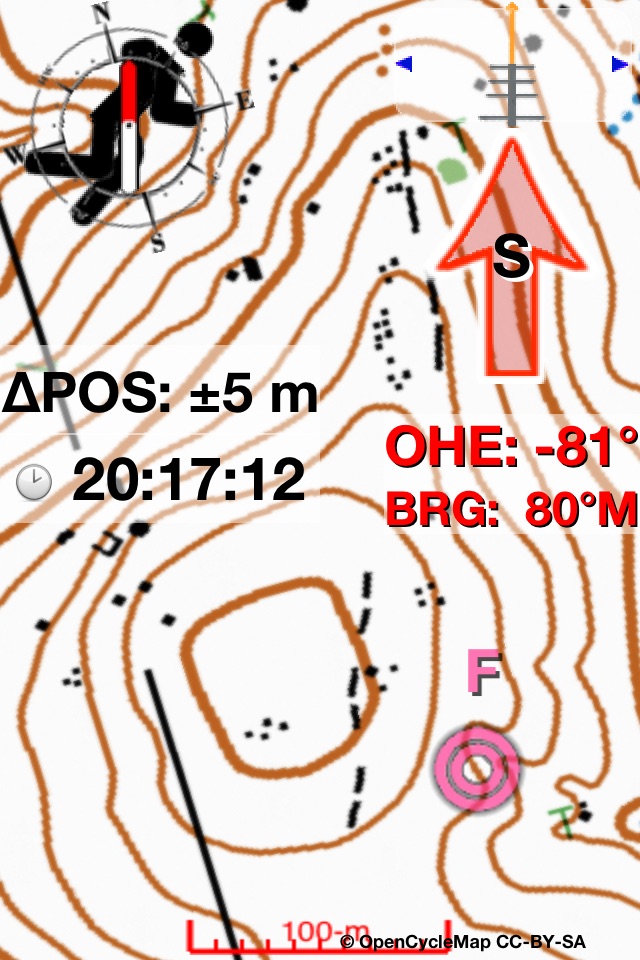
o Text data can be overlaid atop the map: Distance, step count, GPS, and much more.
o Speed and distance unit selection, time format, lat/lon format changes are applied instantly with a single swipe.
o Leg lengths and GPS locations of control points can be displayed for courses you create or download.
o Courses can be created on a PC or Mac running freely-available satellite photo software, then exported and downloaded to the app by email or iTunes file sharing.
o Courses can be created within the app and then shared by email with others using the app, or tweaked on a PC or Mac.
o Results files can be displayed and "animated" in free Earth satellite-view software to "relive" the experience - and combined with the results of others to see locations over time.
ORIENTEERING
o Beginners can see their location on the map, and receive distance and direction hints
o Intermediate level users get fewer hints.
o Advanced level users get no help from the app aside from a convenient paperless map, map rotation support and course display.
ARDF
o Bearings are recorded in "point and shoot" fashion, and are color coded to their intended target.
o From one up to five separate "foxes" can be hunted and tracked.
o Transmitter signals are simulated to provide a remarkably realistic simulated transmitter hunt experience.
o Can be used for bearing recording to live transmitters.
o The app calculates and displays the likely target locations based on bearings taken.
o Results files include bearings and target calculations.